 |
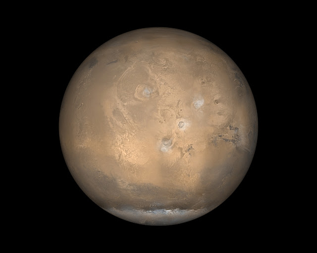
| The Tharsis hemisphere of Mars. The four large volcanoes are marked by clouds and the western half of Valles Marineris is visible at right. Image credit: NASA. |
The MSWG scientists divided into Site Selection and Sample Acquisition teams. The teams held two joint workshops and produced 10 detailed reports before the middle of 1979. Edited by JPL's Neil Nickle, they did not see print until November 1980.
Publication was delayed in part because Mars planning at JPL slowed markedly in early 1979. It would not begin to emerge from the doldrums again until the following year, after President Jimmy Carter's NASA Administrator, theoretical physicist Robert Frosch, created the Solar System Exploration Committee in an (ultimately successful) effort to revitalize the space agency's flagging robotic exploration program.
Because the MSWG reports were based on limited data, they may appear archaic to some readers. Nevertheless, they remain important, for they capture snapshots of the state of Mars science as the busy first era of robotic Mars exploration ended and the long gap began between the Viking missions, which reached Mars in 1976, and Mars Pathfinder and Mars Global Surveyor, which arrived at the planet in 1997.
The first MSWG report, which looked at polar landing sites for the minimum MSR mission, was authored by J. Cutts, K. Blasius, W. Roberts, and K. Pang of the Planetary Science Institute (PSI) of Science Applications, Inc., and A. Howard of the University of Virginia (UV). They submitted their report to JPL on 30 April 1979.
The PSI/UV team began by pointing out that humans had already explored Mars's poles for more than a decade. Mariner 7 had begun close-up martian polar exploration by imaging the entire southern ice cap at low resolution during its August 1967 flyby. Mariner 9 imaged both caps from Mars orbit during 1971-1972, and the Viking 2 orbiter began high-resolution polar imaging in 1976.
In many respects, polar MSR sites constituted a special case, the PSI/UV team wrote. Whereas missions to the other MSR sites would focus mainly on rock samples, the polar MSR mission would acquire meter-long core samples of ice or dust and ice. Rock samples would be "an unplanned bonus."
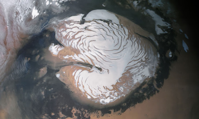 |
| The north pole of Mars. Image credit: NASA. |
They assumed that a landing might safely occur anywhere within a target ellipse 25 kilometers wide by 40 kilometers long, and calculated that a lander that set down in the ellipse would stand at least a 99% chance of landing on perennial ice. For this reason, no mobility (that is, no rover) would be required at Site A.
The second polar site, Site B (84.5° N, 105° W), included perennial ice and "partially defrosted" terraced troughs. The latter, the PSI/UV scientists explained, would "form windows through the layered deposits and cross-sections through martian history." The 25-kilometer-by-40-kilometer Site B target ellipse would also overlap the edge of the permanent ice cap.
Selecting such a varied area would, they warned, reduce the probability of landing on perennial ice to between 60% and 90%. If, however, the Site B mission included a short-range (about 10 kilometers) rover, then the probability of sampling more than one terrain and of sampling perennial ice would increase to greater than 90%.
In discussing the engineering problems of a polar MSR mission, the PSI/UV team cited Purdue University's 1976-1977 Mars Polar Ice Sample Return study (see "More Information," below), but otherwise left engineering to the engineers. Potential problems identified included acquisition and preservation of ice and permafrost cores, mechanical operations at extremely low temperatures, and water and carbon dioxide frost accumulation and evaporation that might impede a rover.
As a "next logical step" toward a polar MSR mission, the PSI/UV scientists recommended establishment of a science working group with "substantial participation by earth scientists involved with studies of terrestrial sedimentary records[,] particularly those pertaining to climate change." They did not recommend an MSR precursor mission; that is, they judged that the Viking missions had provided data adequate for planning a minimum MSR mission to Mars's north pole.
Arizona State University (ASU) geologists R. Greeley, A. Ward, A. Peterfreund, D. Snyder, and M. Womer submitted the second of the 10 MSWG reports to JPL in March 1979. Their quest for a young volcanic MSR site was hampered, they explained, by a dearth of high-resolution (better than 50 meters per pixel) orbital images. Nevertheless, they located six candidate sites that looked to be volcanic and had few craters, signifying youth. (Planetary scientists count craters to estimate terrain age; the more densely craters pock a landscape, the older it is likely to be.)
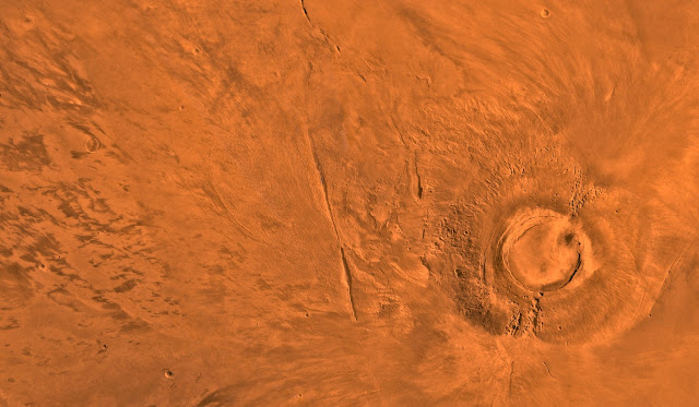 |
| Arsia Mons (right of center) is southernmost of the four great Tharsis volcanoes. ASU's "Arsia Mons West" MSR site is located near the center of the left (west) half of the image. Image credit: NASA. |
The Arsia Mons West site, which had been imaged by the Viking orbiters at 34-meters-per-pixel resolution, included eight overlapping lava flows. The flows measured from eight to 35 kilometers wide and averaged 51 meters thick.
The ASU team found room for two target ellipses 80 kilometers long by 50 kilometers wide on either side of a five-kilometer crater at their site's center. They calculated that a rover with a 14-kilometer range would have a "complete guarantee" of reaching an outcrop of young volcanic rock.
At JPL's request, the ASU geologists also assessed Viking 1's Chryse Planitia landing site as a potential MSR landing site. The volcanic rocks were old at Chryse, a smooth-floored basin at the confluence of several large flood-carved channels. Based on the in-situ evidence provided by Viking 1 lander images, it was clear that no mobility would be needed to acquire a rock sample.
The ASU team noted, however, that the "value of a returned sample [would be] severely diminished because it may be impossible to determine if the material represents local [lava] flows. . .[or] if it has been deposited from the floods that eroded the channels." The ASU team added that "[w]ithout mobility of at least 200 to 300 kilometers, the [Chryse Planitia] site [would be a] a poor choice to answer basic scientific questions about Mars." For neither site did they recommend an MSR precursor mission.
A Young-Lavas Landing Site Northwest of the Volcano Apollinaris Patera and a Landing Site on the Ancient Terrain Southeast of the Schiaparelli Basin, had a single author: Brown University geologist P. Mouginis-Mark. He argued for mobility at his young Elysium Lavas (5° S, 190° W) and Ancient Terrain (8° S, 336° W) minimum MSR sites. The former, 150 kilometers from the Apollinaris Patera volcano, comprised rolling plains with scattered volcanic domes and shields, stratovolcanoes, and fresh impact craters. He identified a ridge running through the center of the 80-by-50-kilometer target ellipse as the feature most likely to yield a "good sample" (that is, a well-preserved volcanic rock representative of the site).
Mouginis-Mark calculated that without mobility the probability of obtaining a good sample would be nil, while the probability of landing on a sand dune and obtaining no sample at all would be as high as 22%. The probability of obtaining a good sample would increase to 91%, however, if the mission included a rover with a round-trip range of 20 kilometers.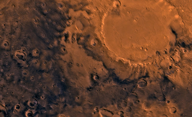 |
| The smooth-floored crater Schiaparelli (top of image, just right of center). Mouginis-Mark's "Ancient Terrain" MSR site is located near the center of the image. Image credit: NASA. |
Mouginis-Mark expected that a good sample might be found on the rim of a fresh crater more than two kilometers across, five of which occurred in Ancient Terrain target ellipse. He calculated that a rover round-trip range of 50 kilometers would be needed to achieve a 90% probability of acquiring a good sample.
For their contribution, USGS geologists H. Masursky, A. Dial, M. Strobell, G. Schaber, and M. Carr recycled four sites that they had studied in 1977-1978 for a proposed Viking follow-on long-range rover mission. Masursky and Dial were co-authors of the Viking '79 traverse study in 1974, while Carr led the Viking orbiter imaging team (and thus was involved in capturing the high-resolution images the minimum MSR Site Selection Team used in preparing its reports).
The USGS sites represented two martian terrain types. Tyrrhena Terra and Iapgyia Terra included ancient cratered terrain similar to that at Mouginis-Mark's Schiaparelli site, which is perhaps unsurprising given that such terrain covers more than 60% of Mars. The sites contained a jumble of overlapping craters and an intercrater mantle of old lava flows.
Samples collected in Tyrrhena and Iapgyia would permit age-dating of the oldest martian crustal material, the USGS geologists wrote. This would enable calibration of the crater counts used for dating martian terrains. In addition, data from the samples could "be compared to comparable analyses made of ancient lunar crustal materials returned by Apollo 16 and [to] ancient terrestrial rocks in order to make interplanetary comparisons of [how rocks are formed], physical and chemical properties, and age."
Of the two sites, Tyrrhena was "superior as a potential sample site in all respects," the USGS team wrote. They proposed that the minimum MSR lander set down where the old lava flows appeared to be thin, near a six-kilometer-diameter crater - one large enough, they judged, to have excavated ancient crust buried beneath the flows. They calculated that a landing ellipse 30 kilometers long and a rover with a 10-kilometer round-trip range would reach only old lava samples.
Obtaining an ancient crustal rock sample ("the primary science objective"), on the other hand, would demand a five-kilometer landing ellipse and a 14-kilometer round-trip rover. Achieving such landing accuracy implied that the minimum MSR lander would be capable of automated guidance and precision maneuvers during descent.
The other two USGS sites, Candor Chasma and Hebes Chasma, were both part of Valles Marineris, Mars's great equatorial canyon system. "These sites," the USGS team wrote, would "offer a unique opportunity to sample rock layers and their interbedded soils that would reveal the petrochemical history, age dates[,] and the history of environmental changes that may correlate with episodes of channel formation" on Mars. They might also yield organic material ("if the present red anorganic climate did not exist at times in the past") and a record of "the history of solar variations."
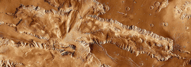 |
| Martian Canyonlands: Candor Chasma. Image credit: NASA. |
The MSWG's fifth report, the first of the six prepared by members of the MSWG Sample Acquisition Team, looked at the availability of rocks on Mars with emphasis on the equatorial Central Latitude Belt, which spanned between 30° N and 30° S. The report's author, University of Houston geologist E. King, explained that celestial mechanics and MSR lander engineering constraints would probably dictate that the Belt contain the first MSR landing site.
The twin Viking landers had had trouble collecting small rocks on Mars, King noted. This had led some to suggest that what looked like rocks at the Viking sites were in fact soft "clods" of martian dirt. If correct, then this hypothesis would mean that rocks were rare on Mars, which would in turn eliminate the primary motivation for an MSR mission; that is, to collect rocks.
King reported that his "evaluation of all of the presently available relevant data" had eliminated this concern "completely" for large parts of Mars, including for the Central Latitude Belt. Especially encouraging were data from the Viking orbiter Infrared Thermal Mapping (IRTM) experiment, which mapped thermal inertia (that is, how long it takes a given surface to become cool at night). Rocky surfaces need longer to cool down than do dusty surfaces.
Viking IRTM data indicated that much of the Central Latitude Belt has thermal inertias as high as 12. "It is very difficult to construct a reasonable model of the martian surface that has a thermal inertia of more than about 3 that does not have a substantial percentage of the surface area covered with rocks," King wrote.
He attributed the Vikings' inability to collect small rocks to inadequacies in the Viking sampler design. After it scooped a sample containing small rocks, controllers on Earth commanded the sampler to turn upside-down and shake for up to two minutes to sieve out dust. King noted that shaking the sampler caused its lid to flap open as much as an inch. This would allow any pebbles it contained to escape.
He advocated collecting rock samples in the form of drilled cores, since drilling could penetrate past any weathered rock rinds. Drilling could also collect uniform cylindrical samples that could be handled easily and stored efficiently in the MSR spacecraft.
King was ambivalent about the need for mobility in an MSR mission; he wrote that, if the objective of the mission were to collect fresh igneous rocks, and if the MSR landing site were similar to the Viking landing sites, then little mobility would be necessary. He added that, while it might be prudent to "build in some additional mobility as a margin of safety and to afford additional possibilities for sample collection. . .such provisions [had to be] traded off against lander science and returned sample weight."
USGS geologist H. Moore wrote the sixth MSWG report, which constituted a tour of the landscape within view of the Viking 1 and Viking 2 lander cameras. Viking 2 landed in Utopia Planitia, near the large impact crater Mie, a region more northerly than Viking 1's site in Chryse Planitia. Like King, Moore wrote that Viking 1 rocks were varied (there were 30 types) and tended to be smaller than Viking 2 rocks. The Viking 2 rock population, for its part, appeared to be dominated by ejecta from Mie.
Moore then described hypothetical rover traverses at the two sites. In each, the rover would visit 17 sampling stations, traverse about 100 meters, and range up to 20 meters from its lander.
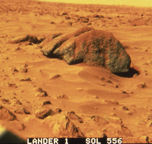 |
| The boulder named "Big Joe" at the Viking 1 landing site in Chryse Planitia. Image credit: NASA. |
Moore estimated that the rover would spend between six and eight days traversing and collecting for each station. Each traverse would thus last from 102 to 136 days. The total mass of samples collected on each traverse would total about two kilograms.
The seventh MSWG report sought to estimate the number of crystalline rocks — that is, volcanic rocks such as basalt — at the Viking landing sites and to plan traverses that would adequately sample them. Its authors, R. Arvidson, E. Guinness, S. Lee, and E. Strickland, geologists in the Department of Earth and Planetary Sciences at Washington University in St. Louis, Missouri, argued that any rock larger than about 10 centimeters in diameter at the Viking sites was a good candidate for being crystalline.
Such rocks, they added, cover 9% of the Viking 1 site and 17% of the Viking 2 site. The former, they wrote, included bedrock exposures and at least four soil types, while the latter included two soil types and no bedrock. They pointed out that, while a sampler arm could probably reach a crystalline rock at either site, it would not be able to sample all of the available materials. For that reason, they proposed that MSR landers at the Viking sites should each deploy a "mini-rover."
The Viking 1 site was "such an interesting place," the Washington University team wrote, that they had planned for it a 40-meter traverse with seven sampling stations (with an option to extend to 50 meters and 10 stations). The basic traverse would collect 10-centimeter core samples from three rocks and four soil samples. The extended traverse would sample two more rocks, including Big Joe, and would gather a total of five soil samples, including very red soil from atop Big Joe.
The Viking 2 site, by contrast, featured minimal variety, so the Washington University team's traverse there would cover only 25 meters and seven stations. The mini-rover would collect four soil samples and core samples from three rocks.
N. Nickle of JPL's Flight Projects Planning Office authored the eighth MSWG report, which was titled Requirements for Monitoring Samples. The report was published originally as a JPL Interoffice Memorandum dated 20 October 1978. Nickle wrote that the "scientific integrity of the returned Martian samples is of prime importance." "Scientific integrity," he explained, meant "the preservation of the physical and chemical state of the acquired samples."
To maintain the scientific integrity of the samples collected during the minimum MSR mission, Nickle recommended that they be kept 20° C cooler than the estimated minimum temperature they had experienced on Mars, and that they be sealed within a container with martian air at typical martian surface pressure. In addition, he recommended that the samples be exposed to no more galactic cosmic and solar radiation than they had been on Mars, and to no magnetic field stronger than Earth's natural field.
The minimum MSR mission sought to control cost in part by avoiding science instrumentation not required for sample collection. In the MSWG's ninth report, J. Warner of NASA's Johnson Space Center (JSC) in Houston, Texas, looked at low-mass, low-power MSR science instruments designed to "provide adequate information to select samples."
His candidate instrument suite included a steerable imager, a reflectance spectrometer, a chemical analyzer on a boom, a boom-mounted densitometer, and a tool for measuring hardness (this might, Warner suggested, be made a function of the sample scoop; the Viking arm and claw had been used to scratch and chip at rocks to judge their hardness).
Warner also prepared the tenth and last report of the Site Selection and Sample Acquisition Study, which he titled A Returned Martian Sample. In it, he looked at the form the minimum MSR sample should take. He looked at two different landing site types: a Viking-like site "laden with a variety of rocks and soils" and a hypothetical "smooth plains site."
The JSC geologist cited Moore's report when he wrote that, at a Viking-like site, an adequate sample could be "obtained on a traverse of a few hundred meters that never leaves the field of view of the lander." He estimated that an atmosphere sample, a soil core, nine rock cores, four small rock fragments, two duricrust samples, and six scoops of soil would adequately represent a Viking-like site. Together these samples would have a mass of 4.1 kilograms.
An eight-month, 15-station traverse could adequately sample a rock-poor smooth plains site, Warner wrote. The rover would range widely over the smooth terrain. Sampling stations would occur at "obstructions" (for example, craters). The rover would drill two or three rock cores and collect one rock fragment at each station, scoop soil at every other station, and collect duricrust at every fifth station. Adding a soil core and an atmosphere sample would bring the total sample mass to 5.7 kilograms if two rock cores were collected and 6.9 kilograms if three cores were collected.
Sources
Mars Sample Return: Site Selection and Sample Acquisition Study, JPL Publication 80-59, Neil Nickle, editor, NASA Jet Propulsion Laboratory, 1 November 1980.
Detailed Reports of the Mars Sample Return Site Selection and Sample Acquisition Study, JPL 715-23, Volumes I-X, Mars Science Working Group Mars Sample Return Study Effort, NASA Jet Propulsion Laboratory, November 1980.
More Information
Mars Polar Ice Sample Return (1976-1978)
Prelude to Mars Sample Return: The Mars 1984 Mission (1977)
Safeguarding the Earth from Martians: The Antaeus Report (1978-1981)
With the benefit of hindsight traverses in the hundreds of kilometers seem absurd considering that Opportunity took 14 years to do 45 kilometers. Also interesting that some of the names writing this report are people I recognize from current rover missions, even though I am an amateur.
ReplyDeleteThere are still people around who haven't figured it out — I was on hand for a presentation by a lunar scientist who proposed an 1800-km traverse spanning a couple of years. I pointed out the pace other rovers have managed and he was not happy. He could not explain what made his proposal different, however. The only way to do a fast robotic traverse would be real-time teleoperations without science stops, and his proposal did not include teleops and did include science stops.
Delete